Apple Maps
By MacRumors Staff
Apple Maps How Tos

Apple Maps May Be Logging Places You Visit – How to Disable
In iOS 26, Apple Maps has a feature called Visited Places that when enabled automatically logs where you've been, with the aim of making it easier to revisit your favorite spots or to share locations with friends.
While it can be useful for tracking your travels, you might prefer to keep your location history private. Here's how to disable the feature and clear your history.
What Is...
Read Full Article (78 comments)
iOS 26: Turn Off Preferred Routes in Apple Maps
In iOS 26, Apple Maps quietly learns your daily driving patterns to help you beat traffic, but you might not want it tracking your regular routes. Here's how to disable the feature.
Using on-device Apple intelligence, Maps learns the routes you prefer to use to get to locations you visit frequently, such as work, home, and school. The app tracks when you typically visit these places and...

iOS 18: Use New Library and Notes Features in Apple Maps
Apple Maps in iOS 18 introduces two helpful new features: a centralized Library for saved content and the ability to add personal notes to locations. Here's how to take advantage of these new tools.
Using the New Library
Apple's iOS 18 update brings significant improvements to the Maps app, and streamlines the process of saving and organizing your favorite locations. Building on the...
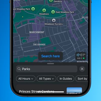
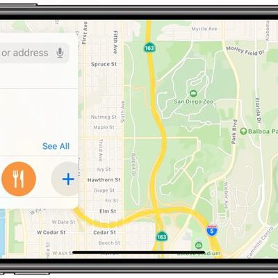
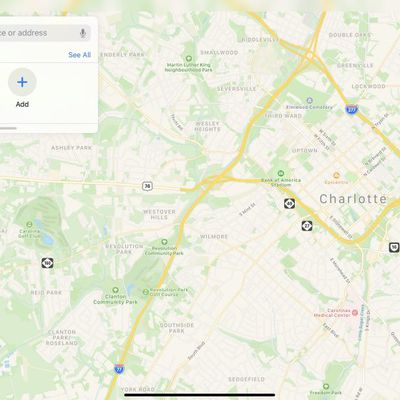
iOS 18: Using the New 'Search Here' Feature in Apple Maps
In iOS 18, Apple Maps has gained a new "Search here" button that makes it much easier to find what you're looking for in areas that aren't your current location or when you're exploring any new place on the map.
In earlier versions of iOS, if you search nearby for, say, gas stations or restaurants in Apple Maps, and then drag the map to another location with your finger, it will usually (but ...
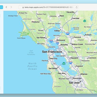
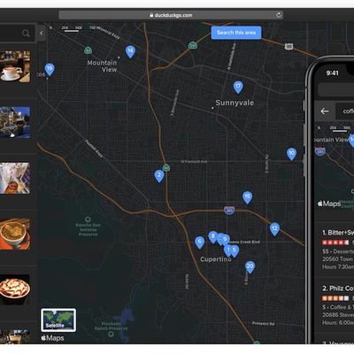
How to Use Apple Maps on the Web
Apple has introduced Apple Maps for the web, currently available in a public beta. This new feature brings the convenience and functionality of the Apple Maps app to web browsers, enabling users to access directions and location information without needing to open the standalone app or even have an Apple device.
With Apple Maps on the web, you can get driving and walking directions, explore ...
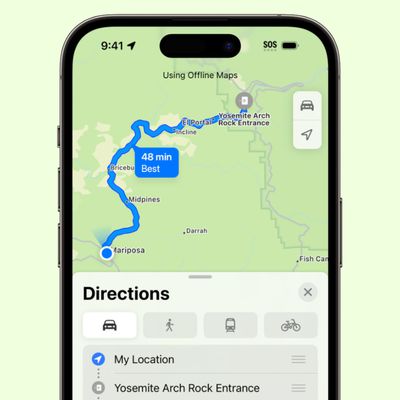
iOS 17: How to Download Offline Maps in Apple Maps
In iOS 17, Apple has added the ability to download Maps for use offline, providing access to turn-by-turn directions and information for a chosen area even if you do not have a cellular or Wi-Fi connection. Keep reading to learn how it's done.
Apple Maps is catching up with Google Maps in iOS 17 by finally letting iPhone users download maps for offline use. Thanks to the new feature, you...
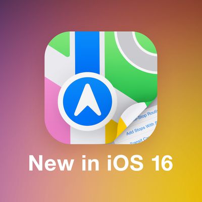
iOS 16: How to Use Multi-Stop Routing in Maps
In iOS 16, Apple Maps has received an update that brings multi-stop routing to the navigation app. Keep reading to learn how to use it.
With iOS 16, the Maps app allows you to plan a route that has multiple stops instead of just a single destination. While Google Maps has had this feature for some time, this is the first version of Apple's Maps app to include support for it.
When entering ...
How to Get a List of Directions in Apple Maps
After several years of iterations and improvements, Apple Maps has become a solid app and a viable Google Maps alternative for getting GPS-based directions to navigate journeys by car, public transport, bicycle, and on foot.
Depending on the journey though, you may want to print off a list of turn-by-turn directions to refer to instead of relying on your iPhone and draining the battery. Or...
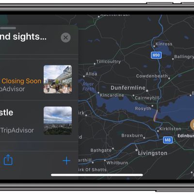
iOS 15: How to Find Fun Things to Do With the Dedicated Apple Maps Guide Section
In iOS 15, has brought several major improvements to the Maps app, with better driving directions, improved transit directions, and more immersive AR-based walking directions.
In addition, Apple has added a dedicated Guides Home that houses editorially curated guides with tips on what to do in a city where you live or where you're visiting.
To explore Apple's guides at any time in the...
iOS 15: How to Find Transit Stations Near You in Apple Maps
In iOS 15, Apple's Maps app benefits from a range of new features and improvements, including the ability get real-time information on the nearby transit options available to you.
This transit information can be found for major bus routes and rail lines in cities with updated maps. Transit riders can see all of the departures listed near them, including any existing delays on services, and...
iOS 15: How to Get AR Walking Directions in Maps
In iOS 15, Apple's Maps app benefits from a range of new features and improvements, including the ability to use augmented reality walking directions in big cities.
In a nod to Google Maps, the new AR mode can map walking directions onto the real world by using your iPhone's rear camera, making it easier to see where you need to go in built-up areas and reducing the need to look down at your ...
iOS 15: How to Find User Settings in Maps
In iOS 15, Apple has added a user account area in the Maps app that corrals several custom areas like direction mode, toll and highway avoidance options, transit options, and more.
To access it, simply tap the circular icon to the immediately to the right of the search bar. You should see your initials within the circle, indicating it's your account.
A new menu card will pop up with...
iOS 15: How to Filter Search Results in Maps
In iOS 15, Apple has worked to improve the search results in its Maps app, and has added the ability to filter results by options like what specific cuisine you're looking for, whether a restaurant is open or offers takeout, and more.
In the following steps, we've demonstrated how it works by looking for restaurants that serve a particular type of cuisine, but you can filter other...
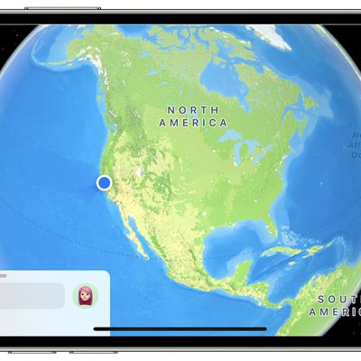
iOS 15: How to Use the Interactive Maps Globe
In iOS 15, Apple has enhanced the Maps app to include a new globe view that allows you to spin the world around and zoom into different regions on Earth.
In previous versions of iOS, zooming out maximally in Maps would present you with a flat world map, but the new globe view gives you a three-dimensional view of Earth from space that's a lot more fun to navigate.
It's easier, too –...
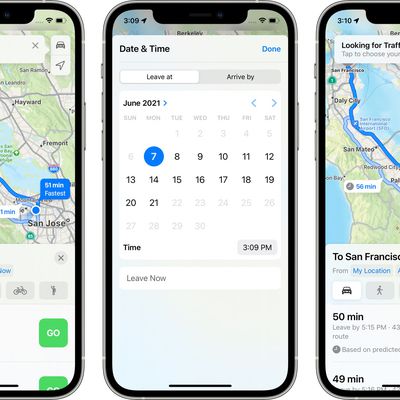
iOS 15: How to Set Leaving and Arrival Times for Driving Directions in Apple Maps
Apple Maps received several notable improvements in iOS 15, including new details in cities, an interactive globe, and enhanced driving directions. It also gained a feature that has long been available in rival map apps – the ability to set leaving and arrival times for driving directions.
This is a feature that's long been available for Google Maps, and one that's really useful if you...
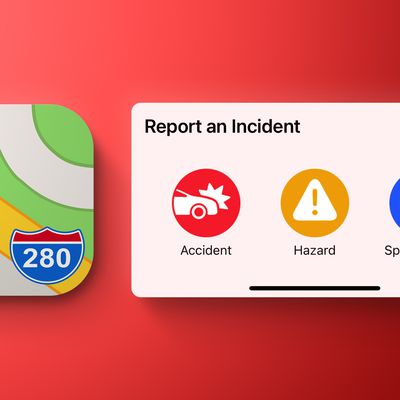
iOS 14.5: How to Report Speed Checks, Traffic Accidents, and Other Hazards in Apple Maps
In iOS 14.5 and later, Apple has added a Waze-like feature to its native Maps app that lets you report accidents, hazards, and speed checks along your route when getting directions. Keep reading to learn how it works.
Driving on public roads can throw up all sorts of hazards, but if you're given prior warning then you can be better prepared to deal with them. Apple recognizes this, which is...
How to Clear Your Location History in Apple Maps
When you search a location in Apple Maps on iOS and Mac, the app conveniently remembers your search in case you want to return to it at a later time.
However whether for housekeeping or privacy reasons, you can quickly and easily remove your Maps search history at any time. Keep reading to learn how its done.
Delete Apple Maps History on iPhone and iPad
Launch Apple's Maps app on your...
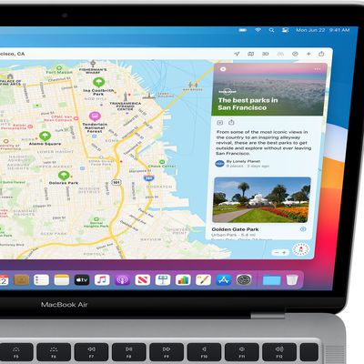
iOS 14: How to Use Guides in Apple Maps
In iOS 14, Apple's Maps app got a handful of new features and refinements, one of which is the ability to explore places with the help of Guides.
Guides provide recommendations for the best places to visit in a city, offering up suggestions on places to eat, shop, and explore. Some of Apple's partners for these Guides include Lonely Planet, the Washington Post, AllTrails, The Infatuation, and ...
iOS 14: How to Get Cycling Directions in Apple Maps
Google Maps has featured detailed cycling directions for almost a decade now, and with the arrival of iOS 14, Apple Maps is finally introducing its own.
The steps below show you how to make use of the new cycling directions in Apple's Maps app. If you have an Apple Watch running watchOS 7 or later, you can receive the directions you select right on your wrist, for easy at-a-glance navigation.
...

How to Ask Siri to Share Your ETA When Navigating With Apple Maps
In iOS 14, Apple has greatly expanded the number of direct answers Siri can give you. The majority of these answers are thanks to enhanced web-based information, but some of it is also down to Siri's tighter integration with other Apple apps.
For example, the Apple Maps app lets you share your estimated time of arrival when you're following turn-based driving directions, and now you can ask ...
How to Share Your Estimated Time of Arrival in Apple Maps
In the latest version of Apple Maps that comes with iOS 13, Apple has added a Share ETA feature that lets you share your estimated time of arrival at a location with a friend or family member, allowing them to follow your progress in real-time for the duration of the trip.
The following steps explain how to use the Share ETA feature in Apple Maps on iPhone and iPad. Note that Apple nixed the...
How to Create a Collection in Apple Maps
In iOS 13, Apple added a Collections feature to its Maps app on iPhone and iPad that lets you search for and aggregate lists of different locations, such as restaurants you're thinking of eating out at, sightseeing locations for when you're on vacation, or other places you want to visit.
Collection lists can also be shared, so you can create lists of places for friends and family that will...
How to Send Feedback About Errors in Apple Maps
In iOS 13, Apple introduced a redesigned customer feedback process for its Apple Maps app which is designed to make it easier for users to submit corrections for things like incorrect addresses, business locations, or operating hours.
If you find an error or something that needs updating in Apple's maps information, you can now send the correct details in just a few quick taps. The following...
How to Add Places to Your Favorites in Apple Maps
In the latest version of Apple Maps that comes with iOS 13, Apple has added a Favorites feature that lets you search for specific places and then add them to a list. Favorites are meant for places that you visit frequently, and Home and Work are already added by default.
Any place you frequent can be added to the Favorites list, such as a favorite restaurant or coffee shop, or a friend or...
How to Use Look Around in Apple Maps
With iOS 13, Apple introduced several additional features to its Maps app, one of which is called Look Around. This gives you a street-level view of what's around your current location or the location you search for on the map.
If you've ever used Google Street View, you already have a good idea of how Look Around works, but Apple's equivalent feature includes a couple of functions that...
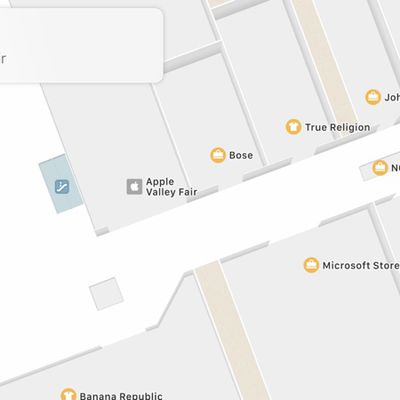
What's New in Maps in iOS 11: Indoor Mapping, Lane Guidance and Speed Limits
The Maps app in iOS 11 is outfitted with several new features that significantly improve the app's functionality. Indoor maps let you find restaurants, bathrooms, and other locations in airports and malls, while other new features like speed limits and lane guidance improve turn-by-turn directions.
Fun fact: In iOS 11, Apple has also updated the Maps icon. The new version is meant to show off...
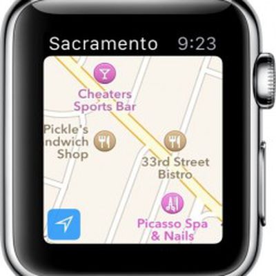
How to Use Apple Watch to Get Directions
Apple Watch includes a miniature version of Apple Maps, which offers many of the same features as the full iOS version if you know how to access them. Some of what Maps can do is fairly obvious, but there are a few features that require a bit more know-how.
If you are interested in learning the ins and outs of Apple Maps on Watch OS and would like to know some simple tips for getting the most...
Apple Maps Guides

iOS 27: All the New Apple Maps Features
The Maps app didn't get as many iOS 27 updates as some of Apple's other apps, but there are still several useful features worth knowing about.
Flyover Improvements
Apple is upgrading Flyover in iOS 27, making it more detailed than before. It combines aerial imagery with Vision Intelligence models to add more texture and sharper visuals for trees, architecture, and more.
Apple says...
Apple Maps: Complete Guide to iOS 13
Apple introduced updates to many of the built-in iOS apps in iOS 13, and Maps is no exception. The updated version of Maps has a long list of new features that are designed to make the Apple Maps app better able to compete with mapping apps from other companies.
There's a new Look Around street view level feature, a Collections feature for aggregating lists of your favorite places, a...
Apple Maps Articles
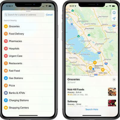
Apple Maps Focuses on Groceries, Food Delivery, Pharmacies and Hospitals When Searching
Apple has updated the search feature in the Apple Maps app to focus on categories that are most important to people right now: groceries, food delivery, pharmacies, hospitals, and urgent care.
These category options come up first when searching, coming ahead of restaurants, fast food, gas stations, banks, and other categories that used to be higher priority in the list.
Places that are...

Job Listing Suggests Recommendations Are Coming to Apple Maps App
Apple recently listed a new Writer/Editor job for the Maps app, which appears to suggest that Apple is planning to build an App Store-like location recommendation feature for Maps.
As noted by The Verge, the job listing, which has since been removed, says that Apple is looking for a person to "help build and grow a brand-new content category for the Apple Maps team," with that person...

Apple Maps Expands 3D Street View Feature to Boston, Philadelphia, and Washington, D.C.
As noted in the MacRumors forums, the new Look Around feature in Apple Maps recently went live in three more cities in the United States, including Boston, Philadelphia, and the Washington, D.C. area.
Introduced in iOS 13, Look Around is an interactive way to visually explore a city with 3D street-level imagery, similar to Google Street View. The feature is also available in the San Francisco...

Apple Maps Transit Directions Go Live in Various EU Countries
Over the last 48 hours, Apple Maps has expanded its transit directions coverage across Europe. Using the app, travelers in cities across France, Germany, Spain, and possibly other countries in the EU are now able to access departure times and transit routes for various modes of public transport including buses, trams, metro trains, and more.
Screenshot credit: @guillamet
Apple has yet to...
Apple Confirms Redesigned Maps App Has Rolled Out to All Users Across United States
Apple today confirmed that its redesigned Maps app is now available for all users across the United States, offering better road coverage, more accurate pedestrian data, more precise addresses, and more detailed views of roads, parks, buildings, airports, and more.
Apple began testing an expansion of the new Maps app to the Southeast and Central United States in late December, which were the...
Revamped Apple Maps Expands to the Southeast and Central United States [Updated]
Apple in December began testing an expansion of its more detailed Apple Maps app in the Central and Southeastern parts of the United States, along with Alaska, and that updated Maps content is now rolling out to all customers.
The revamped Maps app features more extensive geographical details, with updated buildings, roads, parks, sports fields, parking lots, foliage, pools, pedestrian...
Apple Maps Revamp Rolls Out Widely in Western and Midwestern United States
In June 2018, Apple announced that its Maps app would be rebuilt "from the ground up" with more accurate details like grass and trees, pools, parking lots, exact building shapes, sports areas like baseball diamonds and basketball courts, and pedestrian pathways that are commonly walked but previously unmapped.
Apple Maps with revamped data in Western and Midwestern U.S. via Justin O'Beirne ...
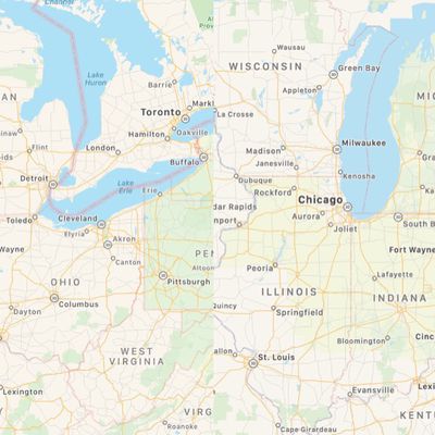
Apple's Maps Revamp Creeps into Midwest U.S.
Apple's Maps app rebuild continues its journey across North America this week, with the company following its pattern of rolling out the enhanced maps in adjacent continental U.S. states.
Before (left) and after – Midwest maps comparison via Reddit user 999999797
Apple has been deploying the enhanced maps up the northeast United States over the last few months, with the rollout recently...

iOS 13 'Look Around' Maps Feature Expands to Los Angeles and New York City
Look Around, a new iOS 13 Maps feature that's designed to provide a street level view of what's around you similar to Google's Street View is now available in Los Angeles and New York City.
At launch and during the iOS 13 beta testing period, Look Around in Maps was limited to the Bay Area of California, Las Vegas, and parts of Hawaii, but Apple is working to expand it to additional locations.
...
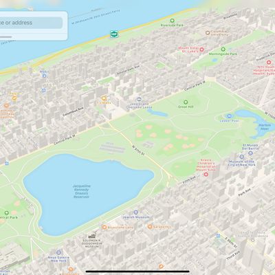
Revamped Apple Maps Rollout Reaches New York City
Apple on Monday began rolling out a major update to its New York City coverage in the Maps app, boosting geographical details and correcting numerous errors in the process, according to the New York Post.
The update should see an increase in details on buildings, roads, parks, sports fields, parking lots, ground cover, foliage, pools, pedestrian pathways, and bodies of water.
For...
Revamped Apple Maps Rollout Extends to Northeast U.S.
Apple's Maps app rebuild continues apace this week, with the company following its pattern of rolling out the enhanced maps in adjacent continental U.S. states.
Last week we reported that revamped Maps had become available across Texas, Louisiana, and the southern half of Mississippi.
Now the rollout is creeping up the northeast United States, taking in the likes of Washington D.C.,...
Revamped Apple Maps Now Available in Texas, Louisiana, and Southern Mississippi
Last year, Apple announced plans to rebuild its Maps app with its own first-party data. The overall look and feel of Apple Maps is similar, but zooming and panning reveals more details like grass, trees, sports fields, and parking lots. Apple is also focused on making search results more relevant.
The improvements first rolled out in Northern California in July 2018, followed by Hawaii and...

Apple Maps Vehicles to Begin Surveying Germany Next Week
Apple Maps vehicles will begin surveying Germany next week, through mid-September, according to the Frankfurter Allgemeine.
The data collected, such as road details, signage, and landmarks, will be used to improve Apple Maps as part of Apple's efforts to revamp the app. The 360º imagery will also likely be used for "Look Around" when Apple eventually expands its new Street View-like feature...
DuckDuckGo Enhances Apple Maps Integration, Including Dark Mode
DuckDuckGo has been using Apple Maps to power map-related searches on both desktop and mobile since January, and today the privacy-focused search engine announced further improvements to that integration.
First, when switching to DuckDuckGo's dark theme, Apple Maps now also automatically switches to a dark appearance.
DuckDuckGo has also added a dedicated Maps tab at the top of every...

Apple Maps in iOS 13: Collections, Favorites, Look Around, and More
There are quite a few changes coming to the Maps app in iOS 13, which gives Apple Maps a feature set that more closely mirrors some of the tools and functionality available in more robust mapping apps like Google Maps.
The most interesting and notable change in Maps is the new Look Around feature, which is Apple's answer to Google's Street View function. Look Around lets you get a street level ...

Apple Maps Vehicles Begin Surveying Canada
Apple today announced that its Apple Maps vehicles are now surveying Canada for the first time over the summer months.
Apple Maps vehicle on Renforth Drive in Toronto via Reddit user whatifyoutry
The vehicles will drive across all 10 provinces between May and November, including British Columbia, Alberta, Saskatchewan, Manitoba, Ontario, Québec, New Brunswick, Nova Scotia, Newfoundland and ...
Apple Maps Gains Detailed Terrain Features for Arizona, New Mexico, and Nevada US States
As part of its ongoing effort to rebuild Apple Maps, Apple has added detailed terrain features to the U.S. states of Arizona and New Mexico as well as the southern portion of Nevada, including the city of Las Vegas.
The enhancements are the result of Apple's street-level data collection using LiDAR-equipped vehicles, which has been going on for over three years. Related improvements first...
Apple Maps Vehicles to Begin Surveying Final U.S. States
As part of its efforts to rebuild Apple Maps, Apple has been collecting street-level data with LiDAR-equipped vehicles for over three years, with at least 45 states across the U.S. partially surveyed to date.
That total is set to rise in the coming months, as Apple has confirmed it will begin surveying Alaska, South Carolina, and Tennessee between March and July, according to an update to...

New Report Delves Into Poor Working Conditions at an Apple Maps 'Black Site'
A new report out today by Bloomberg offers a look inside one of Apple's so-called "black sites," this one a satellite office near Apple Park in California where the company hires contractors to work on Apple Maps. These contract workers were hired by Apex Systems, which staffs and manages a few Apple mapping offices, and creates a "culture of fear" according to former employees.
One former...
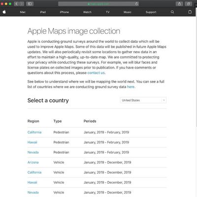
Apple Maps Launches Revamped Data Collection Website
As part of its efforts to rebuild Apple Maps "from the ground up," Apple has been collecting street-level data with LiDAR-equipped vehicles for over three years. Apple also deployed employees wearing LiDAR-equipped backpacks to collect pedestrian-based data starting in California late last year.
As these efforts expand around the world, Apple recently transitioned to a revamped Apple Maps...