
Revamped Apple Maps Expands to the Southeast and Central United States [Updated] - MacRumors
Skip to Content

Revamped Apple Maps Expands to the Southeast and Central United States [Updated]

Apple in December began testing an expansion of its more detailed Apple Maps app in the Central and Southeastern parts of the United States, along with Alaska, and that updated Maps content is now rolling out to all customers.

The revamped Maps app features more extensive geographical details, with updated buildings, roads, parks, sports fields, parking lots, foliage, pools, pedestrian pathways, and bodies of water.
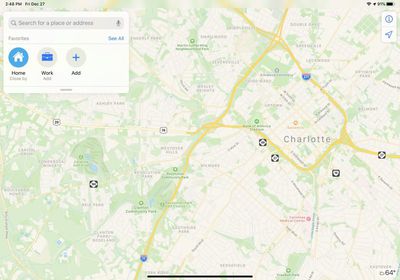
newmapsappsoutheast
To get its mapping data, Apple uses its own vehicles equipped with LIDAR sensors and cameras. Apple has been using this method to collect mapping information for years now.

Apple began rolling out its updated mapping app to customers starting in iOS 12, and at the 2019 Worldwide Developer Conference, Apple said all customers in the United States would receive the improved Maps app by the end of the year.

Apple has made good on that promise with the rollout of the new mapping terrain to large swathes of the United States, and the updated Maps are now becoming available across most of the country. It could still take some time for all users in the Central and Southeastern areas of the U.S. to see the new content. Apple plans to bring the new Maps app to additional countries in 2020.

(Thanks, @tricil and @NateThompson!)

Update: Though Apple has begun releasing the new mapping updates across the United States, updated Maps features are not yet showing up for all users in the Southeast at this time.

Update 2 — Jan 30, 2020: The rollout of revamped ‌Apple Maps‌ in the Southeast and Central United States now appears to be complete. This includes the addition of traffic lights and stop signs in ‌Apple Maps‌ on CarPlay.

Popular Stories

trump lake america

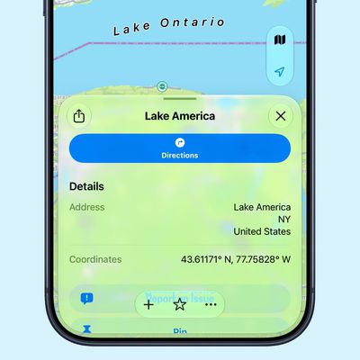
Apple Maps Renames Lake Ontario 'Lake America'

Tuesday September 1, 2026 1:58 pm PDT by
Apple Maps users in the United States will now see "Lake America" instead of "Lake Ontario" for the Great Lake on the border of Ontario and New York. The updated name is currently rolling out to iPhone, iPad, and Mac users. The Maps app still has the Lake Ontario label for the body of water, but tapping it now says "Lake America." Apple will likely change the label in the next few hours....
Apple Maps Google Maps Icons

Google Maps Showing 'Lake America' in U.S., Apple Maps Yet to Follow

Monday August 31, 2026 6:33 am PDT by
Google Maps users in the U.S. will now see the name "Lake America" instead of "Lake Ontario" for the Great Lake that straddles the New York—Ontario border. Google said it made this change in response to the U.S. Geographic Names Information System (GNIS) updating the name for "Lake Ontario" to "Lake America," following an executive order issued by U.S. President Donald Trump last week....
apple maps ads live

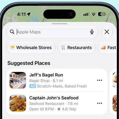
Apple Maps Ads Are Here, and There's No Way to Turn Them Off

Tuesday August 25, 2026 1:40 pm PDT by
Ads in Apple Maps are live in the United States and Canada, which means iPhone and iPad users will see them when searching for locations and when viewing Suggested Places. Apple announced plans to bring ads to the Maps app in March, and said the feature would roll out starting in late summer. Apple confirmed to 9to5Mac that ads began showing up for users over the last few days, with ad...

Top Rated Comments

88 months ago
So that’s the whole world covered then.
Score: 11 Votes (Like | Disagree)
Alan Gordon Avatar
88 months ago
Its good they are making progress, but the fact is, they will forever be behind google.
That's an assumption. There are areas where Apple is behind Google, and other areas where Apple is ahead of Google.
Score: 7 Votes (Like | Disagree)
entropys Avatar
88 months ago
completing rollout? Damn Yanks.

Apple plans to bring the Maps app to additional countries in 2020.
take your time, Apple. Take your own sweet time.
Score: 7 Votes (Like | Disagree)
meaning-matters Avatar
88 months ago
I keep saying it: Maps are unreadable because of the use of very light colors. Especially slightly less light yellow for roads on light yellow background; unbelievable.
Score: 6 Votes (Like | Disagree)
Westside guy Avatar
88 months ago
The single thing that's kept me from switching away from Google's maps is that Google's display of traffic congestion information is easier to grok at a glance. Google adopted the standard green-yellow-red-black paradigm most of the older traffic display systems used, and it's just easier to quickly comprehend.

I notice that, with the revamp, Apple's at least gotten rid of that annoying system of dashes they used to use. But still, it seems like they're trying to be different just for the sake of being different, and sacrificing quick visual interpretation because of it.
Score: 6 Votes (Like | Disagree)
Rogifan Avatar
88 months ago
Is there a way to turn off dark mode just for the Maps app? I fund it much harder to read in dark mode.
Score: 6 Votes (Like | Disagree)