Mysterious Apple Van Captured on Video in Palo Alto Residential Neighborhood
A largely unmarked van with rooftop cameras, similar to the one originally spotted roaming Bay Area streets earlier this month, has been captured on video in Palo Alto, California. MacRumors obtained the footage from reader Jonathan Shiu, who recently recorded the van driving past Juana Briones Park on Clemo Avenue, a residential side street located approximately 10 miles from Apple's headquarters in Cupertino.
It has been increasingly speculated that these fifth-generation Dodge Caravans, which are reportedly leased to Apple, are part of the company's work on an electric car, but it is also possible that the vans are being used for a project similar to Google's Street View. It is conceivable that the rooftop cameras are being used to either collect mapping data for Apple Maps or as sensors to assist with self-driving initiatives.
Earlier this week, the Financial Times reported that Apple is hiring automotive experts to work in a top-secret research lab located near the company's headquarters. The Wall Street Journal soon followed up with a report claiming that Apple has hundreds of employees working on developing an electric vehicle, and Reuters added that the project will involve self-driving cars.
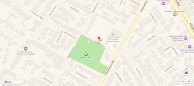
Clemo Avenue in Palo Alto, California, about 10 miles from Apple's HQ in Cupertino
Apple is likely in the early stages of research and development for any electric car project, and it is fully possible that the iPhone maker scraps the initiative before it ever reaches the public. With both Google and Tesla already invested in electric and self-driving vehicles, it will be interesting to see if Apple enters the industry or remains on the sidelines in the months and years ahead.
Popular Stories
Apple's next-generation iPhone 17 Pro and iPhone 17 Pro Max are less than three months away, and there are plenty of rumors about the devices.
Apple is expected to launch the iPhone 17, iPhone 17 Air, iPhone 17 Pro, and iPhone 17 Pro Max in September this year.
Below, we recap key changes rumored for the iPhone 17 Pro models:Aluminum frame: iPhone 17 Pro models are rumored to have an...
The long wait for an Apple Watch Ultra 3 appears to be nearly over, and it is rumored to feature both satellite connectivity and 5G support.
Apple Watch Ultra's existing Night Mode
In his latest Power On newsletter, Bloomberg's Mark Gurman said that the Apple Watch Ultra 3 is on track to launch this year with "significant" new features, including satellite connectivity, which would let you...
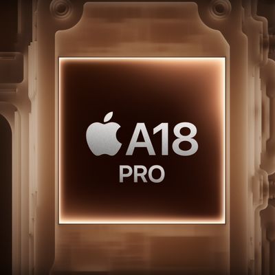
Apple is developing a MacBook with the A18 Pro chip, according to findings in backend code uncovered by MacRumors.
Earlier today, Apple analyst Ming-Chi Kuo reported that Apple is planning to launch a low-cost MacBook powered by an iPhone chip. The machine is expected to feature a 13-inch display, the A18 Pro chip, and color options that include silver, blue, pink, and yellow.
MacRumors...
The upcoming iPhone 17 Pro and iPhone 17 Pro Max are rumored to have a slightly different MagSafe magnet layout compared to existing iPhone models, and a leaked photo has offered a closer look at the supposed new design.
The leaker Majin Bu today shared a photo of alleged MagSafe magnet arrays for third-party iPhone 17 Pro cases. On existing iPhone models with MagSafe, the magnets form a...
Apple is planning to launch a low-cost MacBook powered by an iPhone chip, according to Apple analyst Ming-Chi Kuo.
In an article published on X, Kuo explained that the device will feature a 13-inch display and the A18 Pro chip, making it the first Mac powered by an iPhone chip. The A18 Pro chip debuted in the iPhone 16 Pro last year. To date, all Apple silicon Macs have contained M-series...
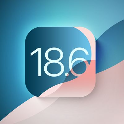
Apple today seeded the second betas of upcoming iOS 18.6 and iPadOS 18.6 updates to public beta testers, with the betas coming just a day after Apple provided the betas to developers. Apple has also released a second beta of macOS Sequoia 15.6.
Testers who have signed up for beta updates through Apple's beta site can download iOS 18.6 and iPadOS 18.6 from the Settings app on a compatible...
iOS 26 and iPadOS 26 add a smaller yet useful Wi-Fi feature to iPhones and iPads.
As spotted by Creative Strategies analyst Max Weinbach, sign-in details for captive Wi-Fi networks are now synced across iPhones and iPads running iOS 26 and iPadOS 26. For example, while Weinbach was staying at a Hilton hotel, his iPhone prompted him to fill in Wi-Fi details from his iPad that was already...
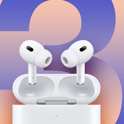
Apple hasn't updated the AirPods Pro since 2022, and the earbuds are due for a refresh. We're counting on a new model this year, and we've seen several hints of new AirPods tucked away in Apple's code. Rumors suggest that Apple has some exciting new features planned that will make it worthwhile to upgrade to the latest model.
Subscribe to the MacRumors YouTube channel for more videos.
Heal...
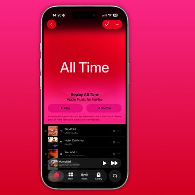
As part of its 10-year celebrations of Apple Music, Apple today released an all-new personalized playlist that collates your entire listening history.
The playlist, called "Replay All Time," expands on Apple Music's existing Replay features. Previously, users could only see their top songs for each individual calendar year that they've been subscribed to Apple Music, but now, Replay All...