
Apple Launches 'Surveyor' App for Apple Maps Data Collection - MacRumors
Skip to Content

Apple Launches 'Surveyor' App for Apple Maps Data Collection

Apple today launched a new app called Surveyor, which is designed to allow users to collect data like images of street signs and roadside details to improve Apple Maps.
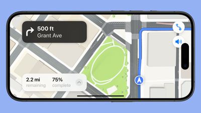
apple surveyor app
The app is not public facing and appears to be for use with companies that Apple partners with to assign mapping tasks. Downloading the app and opening it up directs users to "Open Partner App" to choose a task. Tapping on the option launches another app called Premise.

Premise is a company that lets people earn rewards by "completing simple tasks." The Premise app is described as a task marketplace that provides money for taking surveys, sharing local information like construction zones or grocery pricing, or taking pictures of city locations.

Strings in Apple's Surveyor app found by MacRumors suggest that once assigned a mapping task by the Premise app, Premise users will be instructed to attach an iPhone to a mount, rotate the iPhone to landscape orientation, and capture images along a route while driving using the Surveyor app.

The Surveyor app says that images are being captured of items along the road like signs and traffic lights, location and data about physical features sent to Apple to "precisely place objects on the map."

Premise is not listed as an ‌Apple Maps‌ partner in Apple's mapping data information, but the app suggests that Apple is using data collected by Premise users for the purpose of keeping small details in ‌Apple Maps‌ up to date.

Popular Stories

liquid glass app icon

Apple Maps to Get These 10 New Features in iOS 27

Thursday June 11, 2026 5:45 am PDT by
Apple Maps is getting a range of new features in iOS 27, headlined by an upgraded Flyover experience that uses AI to improve the realism and detail of its aerial imagery. Flyover is a longstanding feature of Apple Maps and lets users explore more than 350 cities in 3D with detailed landmarks, roads, parks, and buildings. Apple described the enhanced Flyover in iOS 27 as combining aerial...
iphone 16e usb c feature

Apple Begins Selling a $419 iPhone

Monday July 6, 2026 6:29 am PDT by
Apple recently added the iPhone 16e to its refurbished store, with U.S. pricing starting as low as $419 for a model with 128GB of storage. Originally released in February 2025, the iPhone 16e is a lower-end device with a 6.1-inch OLED display, an A18 chip with 8GB of RAM for Apple Intelligence support, a single 48-megapixel rear camera, a 12-megapixel front camera, a USB-C port, an Action...
Apple TV Thumb 3

Everything Coming in the 2026 Apple TV 4K

Wednesday July 8, 2026 4:51 pm PDT by
The Apple TV 4K hasn't been updated since 2022, and it's due for a refresh. An update is planned for 2026, but Apple is likely going to wait to launch it after Siri AI launches in iOS 27. Design Apple TV design updates don't happen often, and that's not changing. The next Apple TV is going to have the same squircle shape as the current model, and it'll continue to be made from a black...

Top Rated Comments

minhrom Avatar
17 months ago
I'm not using Maps until Apple stop relying on Yelp for information!
Score: 19 Votes (Like | Disagree)
turbineseaplane Avatar
17 months ago
Filed under “good news that should have been from 2015”
Score: 16 Votes (Like | Disagree)
cateye Avatar
17 months ago

Why they never bought Open Street Maps is way beyond me. Maybe they couldn’t, but maps.me was superior to Apple Maps years ago thanks to offline maps and accurate GPS tracking, as well as much much more info and actually accurate information and locations.
This is just admitting defeat.
Also it’s a slap in the face of everyone that isn’t in the US, again.
Apple, do you know where your maps fall flat the most? Exactly.
Open Street Maps is a not-for-profit foundation that coordinates volunteer mapping and GIS processing to produce a fully open and redistributable set of data. The data is held under open-source licenses and free for anyone to use with proper attribution. As a result, it would not be possible for Apple to "buy" them. There's nothing to buy when the core product is open source.

Apple has used OSM data in specific regions where there either wasn't complete commercial data or the commercial provider was unwilling to license it to them, but their long term goal has likely always been to generate and control their own data, much as Google does (and hence why this app and the partnership with Premise exists).
Score: 11 Votes (Like | Disagree)
thejadedmonkey Avatar
17 months ago
Hopefully they can capture some "no left turn" signs with this. There's one location where it's always trying to get me to make a left right in front of a no left turn sign. I've reported it a few times, but the maps interface doesn't make it easy to explain signage.
Score: 8 Votes (Like | Disagree)
17 months ago

I'm not using Maps until Apple stop relying on Yelp for information!
I don’t mind the integration as a quick way to check reviews. But yes, way too many times I relied on Maps for business hours and went only to find the place closed. I usually check google afterward and see google was accurate.

Score: 7 Votes (Like | Disagree)
17 months ago

A multi trillion dollar company asking its customers for help in making their crappy product better. Here’s a thought: hire people to canvas the US like Google did instead of worrying about beating Wall Street’s earnings estimates!

You do realise that Google also asks users to contribute right?
Score: 6 Votes (Like | Disagree)