Transit
By MacRumors Staff
Transit Articles
Apple Maps Transit Directions Now Available in Ottawa, Edmonton, and Québec City
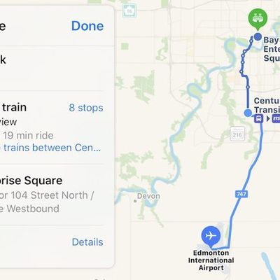
Apple Maps has been updated with comprehensive transit data in the Edmonton, Alberta area, enabling iPhone users in Canada's fifth most populous city to navigate with public transportation, including buses and trains.
Apple Maps can provide routes for both Edmonton Transit System (ETS) buses and Edmonton Light Rail Transit (LRT) trains throughout the Edmonton area, including to and from the...
Read Full Article 16 comments

Apple Maps Transit Directions Now Available in Hungary
Apple Maps has been updated with transit data in Hungary, enabling iPhone users to navigate with public transportation directions in Budapest, Debrecen, Szeged, Miskolc, Győr, Pécs, and other regions of the country.
In the Budapest metropolitan area, supported vehicles include the Budapest Metro, BKV buses and trams, and BHÉV trains.
MÁV-START trains are also supported throughout Hungary ...

Apple Maps Transit Directions Expand to Brisbane, Perth, and Surrounding Areas in Australia
Apple Maps has been updated with transit data in Queensland and Western Australia, enabling iPhone users to navigate with public transportation directions in large cities such as Brisbane and Perth, and surrounding areas.
In Brisbane, supported vehicles include TransLink buses and Queensland Rail trains, with routes extending to, from, and within the Gold Coast and Sunshine Coast suburbs....

Apple Maps Transit Directions Now Available in Las Vegas and Western Nevada
Apple Maps has been updated with comprehensive transit data in several higher populated areas of Nevada, enabling iPhone users to navigate with public transportation directions throughout the Silver State.
Newly supported areas include Las Vegas, including the nearby cities of North Las Vegas and Henderson, as well as the state capital Carson City and the Reno-Sparks metropolitan area in...
Apple Maps Transit Directions Now Available in Calgary and Southern Alberta
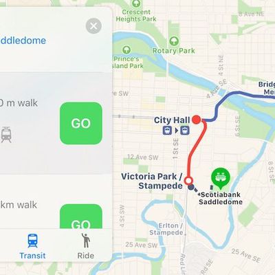
Apple Maps has been updated with comprehensive transit data in Calgary, Alberta, enabling iPhone users in the Canadian city to navigate with public transportation, including the CTrain light rail system and buses.
Apple Maps transit directions are also available for buses in the smaller Southern Alberta cities of Red Deer, Lethbridge, and Medicine Hat.
Apple Maps enabled transit routing...
Apple Maps Transit Directions Start Rolling Out in Madrid
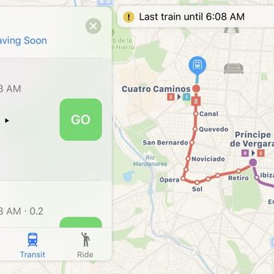
Apple recently updated its Maps app to add transit directions and data for Madrid, Spain, one of the cities where hints of transit support first surfaced months ago.
When searching for directions in Madrid, transit options that include the Empresa Municipal de Transportes de Madrid bus line, the Cercanías Madrid, and the Madrid Metro are now available. Madrid does not, however, have full...
Apple Maps Transit Directions Now Supported in the Netherlands
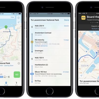
Apple Maps has been recently updated with public transit information for those living in and traveling to the Netherlands. Transit directions allow users to navigate the Netherlands thanks to integration with the Intercity direct train line, various bus routes, trams, and ferries.
Transit in the Netherlands includes up-to-date advisory information with the help of data accumulated from...
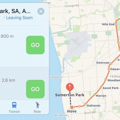
Apple Maps Transit Directions Now Available in Adelaide, Australia
Apple Maps has been updated with comprehensive transit data in Adelaide, Australia, enabling iPhone users in the city to navigate with public transportation, primarily including Adelaide Metro buses and commuter trains.
Apple Maps gained a Transit tab in iOS 9. The feature lags several years behind Google Maps, but Apple's public transportation support is exhaustive, mapping all station...

Apple Maps Transit Directions Now Available in Singapore
As Apple prepares to open its first retail store in Singapore, the company has also expanded Apple Maps feature availability in the city-state, enabling transit directions.
Transit information may still be in the process of rolling out to all customers, but according to the iOS section of Apple's Singaporean website, and a feature availability list, transit directions are live in Singapore.
...

Apple Maps Now Supports Transit in Paris
Apple Maps has been updated with transit data for Paris, enabling iPhone users in the city and the greater Île-de-France region to navigate with public transportation, including the subway, commuter trains, and buses.
Apple Maps supports many public transportation services operated by the RATP Group, including the Métro subway system, RER commuter trains, and buses. Transilien trains and...
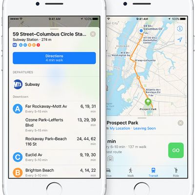
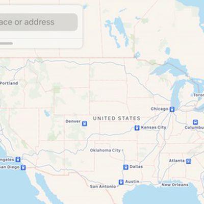
Apple Maps Hints at Transit Directions Expanding in United States, Australia, Canada, and Europe
Apple Maps has had a Transit tab since iOS 9, enabling iPhone users to navigate using buses, trains, and other forms of public transportation.
At launch, the feature was limited to Baltimore, Berlin, Boston, Chicago, London, Los Angeles, Mexico City, New York, Philadelphia, San Francisco, Sydney, Toronto, and over 300 cities in China. Since then, Apple has been working to expand support for...

Apple Maps Now Provides Transit Directions in Detroit and Windsor
Apple Maps has been updated with comprehensive transit data for the Detroit, Michigan metropolitan area, and for the Canadian city of Windsor, Ontario directly across the Detroit River, enabling users in both cities and certain suburbs to navigate using public transportation such as buses and trains.
In the Metro Detroit area, Apple Maps routing supports DDOT and SMART buses, the Detroit...
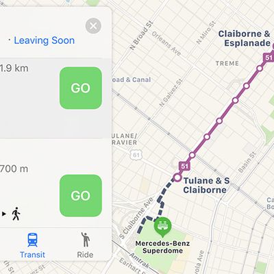
Apple Maps Now Provides Transit Directions in New Orleans Ahead of Mardi Gras
Apple Maps has been updated with comprehensive transit data for the New Orleans, Louisiana metropolitan area, enabling iPhone users in the city and select suburbs to navigate using public transportation, including RTA buses and streetcars. Jefferson Transit buses and Amtrak routing is also available in the area.
Apple introduced Transit in Maps as part of iOS 9 in select cities around the...
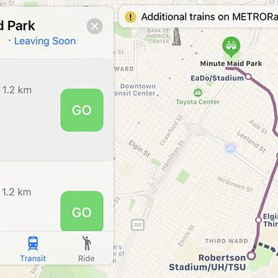
Apple Maps Now Provides Transit Directions in Houston Ahead of Super Bowl
Apple Maps has been updated with comprehensive transit data for the Houston, Texas metropolitan area, enabling iPhone users in the city and select Harris County suburbs to navigate using public transportation, including METRO buses and METRORail. Amtrak also goes through Houston, as previously supported by Apple Maps.
Apple introduced Transit in Maps as part of iOS 9 in select cities around...

Apple Maps Expands Transit Directions Across Great Britain
Apple Maps has been updated with comprehensive transit data for Great Britain, beyond the London area already supported.
Transit directions by bus, train, or tram are now available within and between large metropolitan areas such as Birmingham, Manchester, Liverpool, Newcastle, Sheffield, Glasgow, Edinburgh, Leeds, Bradford, Bristol, Portsmouth, Nottingham, and Cardiff, as well as other...
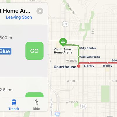
Apple Maps Now Supports Transit Directions in Salt Lake City
Apple Maps has been updated with comprehensive transit data for Salt Lake City, Utah, enabling iPhone users in the city and certain suburbs to navigate using Utah Transit Authority public transportation, including the TRAX light rail system, FrontRunner commuter train, S-Line streetcar, and buses.
Apple introduced Transit in Maps as part of iOS 9 in select cities around the world, including...
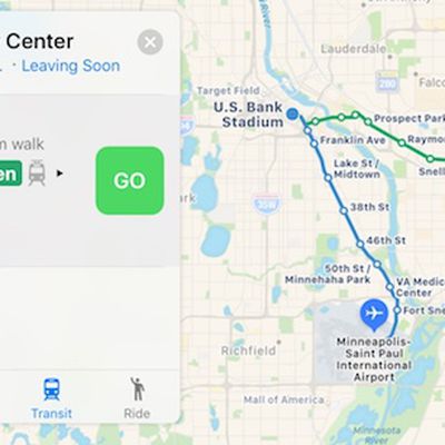
Apple Maps Now Supports Transit in Minneapolis–Saint Paul
Apple Maps has been updated with comprehensive transit data for Minnesota's twin cities Minneapolis and Saint Paul, enabling iPhone users in the metropolitan area to navigate using public transportation, including Metro Transit buses and trains.
Apple introduced Transit in Maps as part of iOS 9 in select cities around the world, including Baltimore, Berlin, Boston, Chicago, London, Los...
Apple Maps Now Supports Amtrak's Full System in U.S. and Canada
Apple has recently updated Apple Maps to include Amtrak's full system of train routes across the United States and in select Canadian cities.
Building upon support for northeast routes, Apple Maps now supports Amtrak routes in the Midwest, Northwest, South, and West regions of the U.S., and in the Canadian cities of Montréal and Vancouver. Amtrak routing is available mainly in areas where...
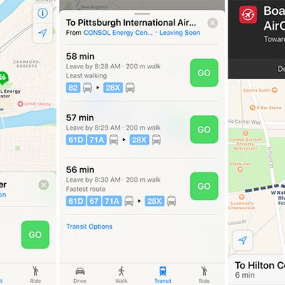
Apple Maps Expands Transit Data to Columbus and Pittsburgh
Apple Maps has been updated with comprehensive transit data for the U.S. cities of Columbus, Ohio and Pittsburgh, Pennsylvania, enabling iPhone users in the areas to navigate using public transportation, including buses or light rail.
Transit routing options in the Pittsburgh metropolitan area include Port Authority of Allegheny County buses and light rail, while directions for Central Ohio...
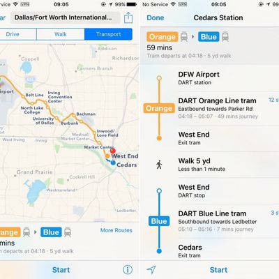
Apple Maps Expands Transit Data to San Antonio and Dallas-Fort Worth
Apple continues to build upon the transit coverage of Apple Maps, today adding the Dallas-Fort Worth metroplex and the City of San Antonio to supported areas in Texas. The support marks the first expansion of transit coverage beyond the state's capital of Austin.
In Dallas and Fort Worth, Apple will now offer up several city transit routes, including transportation by the Dallas Area Rapid...