Apple recently updated its Maps app to add transit directions and data for areas in Alaska, Wyoming, and Idaho.

Apple Maps users in select cities in these states can now select public transportation routes when getting directions between two locations. In Alaska, for example, there are bus routes and other transit options in cities that include Anchorage, Juneau, and Fairbanks.

applemapstransitinfo
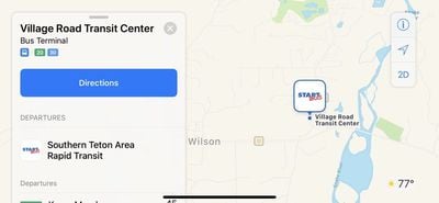
In Wyoming, transit options are available in areas that include Cheyenne and Jackson, and in Idaho, transit data is available in Victor.

Transit information appears to still be rolling out in these three states and could expand to additional cities over the course of the next few weeks.

Apple has not yet added Wyoming, Alaska, and Idaho to the website where it lists locations where transit directions are available, but it should be added in the near future.

Transit directions were first added to Apple Maps in 2015 with the launch of iOS 9. Maps initially only offered transit information in a handful of cities, but over the course of the last three years, Apple has worked to expand the feature to additional areas.

Transit information is now live in dozens of cities and countries around the world, with a full list available on Apple's iOS 11 Feature Availability website.

(Thanks, Ram!)

Top Rated Comments

riverfreak Avatar
62 months ago
Only transit directions anyone is ever looking for in Idaho is "How do I get out of this boring state?"
Yeah because amazing mountains and rivers and wide open spaces really suck.
Score: 11 Votes (Like | Disagree)
speedyg256 Avatar
62 months ago
Only transit directions anyone is ever looking for in Idaho is "How do I get out of this boring state?"
Yes, it’s absolutely terrible. Please tell everyone you know/meet to never even visit. Especially if you live in California.
Score: 4 Votes (Like | Disagree)
Gasu E. Avatar
62 months ago
One feature I'd like to see in Apple Maps would be to define a hybrid trip, where you drive to a parking lot at the end of a rapid transit line, then take public transit into the city. Not so much for the directions, but to have a convenient way to get the current estimated travel time.
Score: 4 Votes (Like | Disagree)
mrow Avatar
62 months ago
I wasn’t aware any of these states actually had public transportation.
Score: 4 Votes (Like | Disagree)
Aluminum213 Avatar
62 months ago
Just another five years before they reach Google maps of 10 years ago, keep it up Apple
Score: 3 Votes (Like | Disagree)
OldSchoolMacGuy Avatar
62 months ago
Yeah because amazing mountains and rivers and wide open spaces really suck.
Certainly can't get that in countless other states.
Score: 3 Votes (Like | Disagree)