Mysterious Apple Van Captured on Video in Palo Alto Residential Neighborhood
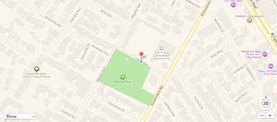
A largely unmarked van with rooftop cameras, similar to the one originally spotted roaming Bay Area streets earlier this month, has been captured on video in Palo Alto, California. MacRumors obtained the footage from reader Jonathan Shiu, who recently recorded the van driving past Juana Briones Park on Clemo Avenue, a residential side street located approximately 10 miles from Apple's headquarters in Cupertino.
It has been increasingly speculated that these fifth-generation Dodge Caravans, which are reportedly leased to Apple, are part of the company's work on an electric car, but it is also possible that the vans are being used for a project similar to Google's Street View. It is conceivable that the rooftop cameras are being used to either collect mapping data for Apple Maps or as sensors to assist with self-driving initiatives.
Earlier this week, the Financial Times reported that Apple is hiring automotive experts to work in a top-secret research lab located near the company's headquarters. The Wall Street Journal soon followed up with a report claiming that Apple has hundreds of employees working on developing an electric vehicle, and Reuters added that the project will involve self-driving cars.
Clemo Avenue in Palo Alto, California, about 10 miles from Apple's HQ in Cupertino
Apple is likely in the early stages of research and development for any electric car project, and it is fully possible that the iPhone maker scraps the initiative before it ever reaches the public. With both Google and Tesla already invested in electric and self-driving vehicles, it will be interesting to see if Apple enters the industry or remains on the sidelines in the months and years ahead.
Popular Stories
Game emulator apps have come and gone since Apple announced App Store support for them on April 5, but now popular game emulator Delta from developer Riley Testut is available for download. Testut is known as the developer behind GBA4iOS, an open-source emulator that was available for a brief time more than a decade ago. GBA4iOS led to Delta, an emulator that has been available outside of...
The first approved Nintendo Entertainment System (NES) emulator for the iPhone and iPad was made available on the App Store today following Apple's rule change. The emulator is called Bimmy, and it was developed by Tom Salvo. On the App Store, Bimmy is described as a tool for testing and playing public domain/"homebrew" games created for the NES, but the app allows you to load ROMs for any...
Last September, Apple's iPhone 15 Pro models debuted with a new customizable Action button, offering faster access to a handful of functions, as well as the ability to assign Shortcuts. Apple is poised to include the feature on all upcoming iPhone 16 models, so we asked iPhone 15 Pro users what their experience has been with the additional button so far. The Action button replaces the switch ...
A decade ago, developer Riley Testut released the GBA4iOS emulator for iOS, and since it was against the rules at the time, Apple put a stop to downloads. Emulators have been a violation of the App Store rules for years, but that changed on April 5 when Apple suddenly reversed course and said that it was allowing retro game emulators on the App Store. Subscribe to the MacRumors YouTube channel ...
iOS 18 is expected to be the "biggest" update in the iPhone's history. Below, we recap rumored features and changes for the iPhone. iOS 18 is rumored to include new generative AI features for Siri and many apps, and Apple plans to add RCS support to the Messages app for an improved texting experience between iPhones and Android devices. The update is also expected to introduce a more...
Top Rated Comments
HEY GUYS! IT'S THAT NEW APPLE MINIVAN! LET'S SEE IF IT'S ONE OF THOSE SELF DR*thudunk**thudunk*.
With that said, maybe it was Googles plan all along, but given how awful the original street view photos were, I don't think they ever intended to make the images public. Rather they used them internally to improve maps. Somebody likely said one day "Hey, maybe our users would find these images useful."
If I were to throw in my guess as to what Apple is doing, I would say it's a mix between street view and flyover. Flyover looks great from far away, but is pretty rough at street level. If Apple is driving around and taking "flyover" photos at street level, that could create something as useful as street view, but have it actually have dimension instead of being flat photos. That could be really useful and cool, while also serving the basic purpose of improving map data.